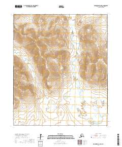
2017 Map of Bendeleben A-3 NW
USGS Topo · Published 2017About this map
Seward Peninsula terrain dominates this northern landscape, where the drainage patterns of the Boston Creek and Baker Creek systems carve through the high elevations of the Nome Census Area. This region of Alaska is defined by its dramatic relief and glacial-cut valleys, illustrated here through the complex meandering of Boston Creek as it moves south. The confluence of smaller tributaries like Oregon Creek reflects a wilderness that remains largely undeveloped, mapped here with precision following the Public Land Survey System grids of t3s r23w and t4s r23w. For the historian or geographer, these waterways provide the primary landmarks in an area where the topography itself serves as the chief record of the land.
Find a feature on this map
11 named features on this map. Tap any name to fly to it.
Don’t see what you’re looking for? This feature index may not catch every label — zoom into the map to look around manually.
Map Details
Editions of this 2017 Bendeleben A-3 NW Map
This is the sole edition of this map. No revisions or reprints were ever made.
Other maps of this area

1950 · Bendeleben A-4
USGS Topo · 1:63,360

1950 · Bendeleben A-3
USGS Topo · 1:63,360

1950 · Bendeleben B-4
USGS Topo · 1:63,360

1950 · Bendeleben B-3
USGS Topo · 1:63,360

1950 · Bendeleben
USGS Topo · 1:250,000

1951 · Bendeleben
USGS Topo · 1:250,000

1964 · Bendeleben
USGS Topo · 1:250,000

1970 · Bendeleben A-4
USGS Topo · 1:63,360
2017 · Bendeleben A-4 NE
USGS Topo · 1:25,000
2017 · Bendeleben B-3 SE
USGS Topo · 1:25,000