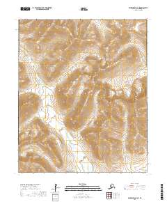
2017 Map of Bendeleben A-4 NE
USGS Topo · Published 2017About this map
The Bendeleben Mountains dominate this section of the Seward Peninsula, where high-elevation drainage patterns define the landscape of the Nome Census Area. The Pargon River serves as the primary hydrological artery, winding through a complex network of tributaries including Dillon Creek, Boston Cr, and Helena Cr. A significant indication of human intervention in this remote environment is the Pargon Ditch, a linear feature cutting across the western slopes. This structure represents the region's historical reliance on water diversion for large-scale mining operations, a common engineering feat in the Alaskan interior where water was redirected from natural flows to support hydraulic mining. The map also records ಹಲವಾರು specific watercourses such as Baker Cr and Oregon Cr, which carve through the high-relief terrain of the Seward Peninsula.
Find a feature on this map
17 named features on this map. Tap any name to fly to it.
Don’t see what you’re looking for? This feature index may not catch every label — zoom into the map to look around manually.
Map Details
Editions of this 2017 Bendeleben A-4 NE Map
This is the sole edition of this map. No revisions or reprints were ever made.
Other maps of this area

1950 · Bendeleben A-4
USGS Topo · 1:63,360

1950 · Bendeleben A-3
USGS Topo · 1:63,360

1950 · Bendeleben B-4
USGS Topo · 1:63,360

1950 · Bendeleben B-3
USGS Topo · 1:63,360

1950 · Bendeleben
USGS Topo · 1:250,000

1951 · Bendeleben
USGS Topo · 1:250,000

1964 · Bendeleben
USGS Topo · 1:250,000

1970 · Bendeleben A-4
USGS Topo · 1:63,360
2017 · Bendeleben A-4 SW
USGS Topo · 1:25,000
2017 · Bendeleben B-4 SW
USGS Topo · 1:25,000