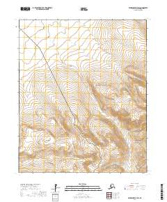
2017 Map of Bendeleben B-4 SW
USGS Topo · Published 2017About this map
The Bering Land Bridge National Preserve occupies much of this landscape on the Seward Peninsula, protecting a vast area of tundra and rolling highlands. The map shows a region defined by its hydrography, particularly the winding course of Ella Cr, which traverses multiple townships from north to south. Near the southern boundary, Birch Cr cuts through the terrain, suggesting the drainage patterns typical of this subarctic environment. The absence of roads or permanent settlements within the survey area highlights the wilderness character of this part of Alaska. This 2017 edition provides a detailed look at the relief and natural watercourses, which are essential markers for navigating the public lands and identifying land use boundaries in the remote interior.
Find a feature on this map
10 named features on this map. Tap any name to fly to it.
Don’t see what you’re looking for? This feature index may not catch every label — zoom into the map to look around manually.
Map Details
Editions of this 2017 Bendeleben B-4 SW Map
This is the sole edition of this map. No revisions or reprints were ever made.
Other maps of this area

1950 · Bendeleben B-5
USGS Topo · 1:63,360

1950 · Bendeleben A-4
USGS Topo · 1:63,360

1950 · Bendeleben A-5
USGS Topo · 1:63,360

1950 · Bendeleben B-4
USGS Topo · 1:63,360

1950 · Bendeleben
USGS Topo · 1:250,000

1951 · Bendeleben
USGS Topo · 1:250,000

1964 · Bendeleben
USGS Topo · 1:250,000

1970 · Bendeleben A-4
USGS Topo · 1:63,360
2017 · Bendeleben B-5 NE
USGS Topo · 1:25,000
2017 · Bendeleben A-5 NE
USGS Topo · 1:25,000