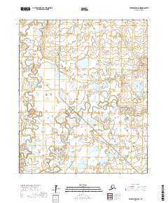
2017 Map of Bendeleben B-5 NE
USGS Topo · Published 2017About this map
Bering Land Bridge National Preserve encompasses a significant portion of this Arctic landscape, where a complex network of meandering waterways defines the Seward Peninsula's interior. The Kuzitrin River winds through the southern half of the sheet, joined by smaller tributaries such as Ella Cr and Minnie Cr. To the west, the Noxapaga River flows north, while Little Garfield Cr enters from the margin. This 2017 survey details a region characterized by its lack of established roads or permanent settlements, showcasing the intricate drainage patterns and thousands of small tundra ponds that dominate the Seward Peninsula. The map provides a precise record of the hydrological environment within the preserve's boundaries, reflecting the remote and unchanged character of the Alaska wilderness in the early twenty-first century.
Find a feature on this map
10 named features on this map. Tap any name to fly to it.
Don’t see what you’re looking for? This feature index may not catch every label — zoom into the map to look around manually.
Map Details
Editions of this 2017 Bendeleben B-5 NE Map
This is the sole edition of this map. No revisions or reprints were ever made.
Other maps of this area

1950 · Bendeleben C-5
USGS Topo · 1:63,360

1950 · Bendeleben B-5
USGS Topo · 1:63,360

1950 · Bendeleben B-4
USGS Topo · 1:63,360

1950 · Bendeleben C-4
USGS Topo · 1:63,360

1950 · Bendeleben
USGS Topo · 1:250,000

1951 · Bendeleben
USGS Topo · 1:250,000

1964 · Bendeleben
USGS Topo · 1:250,000
2014 · Bendeleben C-5 SW
USGS Topo · 1:25,000
2017 · Bendeleben B-5 SW
USGS Topo · 1:25,000
2017 · Bendeleben B-5 SE
USGS Topo · 1:25,000