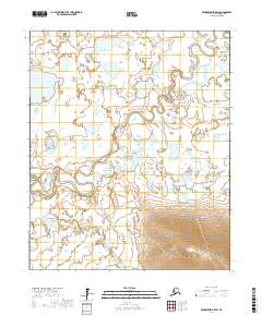
2017 Map of Bendeleben B-5 SW
USGS Topo · Published 2017About this map
The Kuzitrin River meanders across this portion of the Seward Peninsula, defining a landscape of intricate hydrological patterns and expansive lowlands. In the northeastern corner, the Kuzitrin Flats represent a significant alluvial feature where the river's path becomes particularly serpentine. This 2017 survey by the U.S. Geological Survey captures the remote drainage systems of the Nome Census Area, highlighting the confluence of several tributaries.
Find a feature on this map
13 named features on this map. Tap any name to fly to it.
Don’t see what you’re looking for? This feature index may not catch every label — zoom into the map to look around manually.
Map Details
Editions of this 2017 Bendeleben B-5 SW Map
This is the sole edition of this map. No revisions or reprints were ever made.
Other maps of this area

1950 · Bendeleben A-6
USGS Topo · 1:63,360

1950 · Bendeleben B-5
USGS Topo · 1:63,360

1950 · Bendeleben B-6
USGS Topo · 1:63,360

1950 · Bendeleben A-5
USGS Topo · 1:63,360

1950 · Bendeleben
USGS Topo · 1:250,000

1951 · Bendeleben
USGS Topo · 1:250,000

1964 · Bendeleben
USGS Topo · 1:250,000
2014 · Bendeleben B-6 NE
USGS Topo · 1:25,000
2017 · Bendeleben B-5 NE
USGS Topo · 1:25,000
2017 · Bendeleben A-5 NE
USGS Topo · 1:25,000