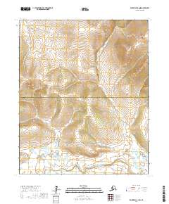
2017 Map of Bendeleben B-1 NW
USGS Topo · Published 2017About this map
The Koyuk River flows through the southern portion of this interior landscape, marking a significant drainage point for the surrounding uplands. Located along the boundary between the Northwest Arctic Borough and Nome Census Area, the map documents a transition in administrative jurisdiction within this undeveloped stretch of Alaska. Tributaries such as Big Bar Cr and Boomer Cr carve through the terrain, illustrating the natural watershed patterns of the Seward Peninsula. This 2017 survey provides a high-resolution look at the hydrography of the region, emphasizing the primitive watercourses like Goose Cr that define the local geography. The lack of modern road infrastructure underscores the isolation of these borough lands, where the natural river systems serve as the primary landmarks.
Find a feature on this map
9 named features on this map. Tap any name to fly to it.
Don’t see what you’re looking for? This feature index may not catch every label — zoom into the map to look around manually.
Map Details
Editions of this 2017 Bendeleben B-1 NW Map
This is the sole edition of this map. No revisions or reprints were ever made.
Other maps of this area

1950 · Bendeleben C-1
USGS Topo · 1:63,360

1950 · Bendeleben B-2
USGS Topo · 1:63,360

1950 · Bendeleben C-2
USGS Topo · 1:63,360

1950 · Bendeleben B-1
USGS Topo · 1:63,360

1950 · Bendeleben
USGS Topo · 1:250,000

1951 · Bendeleben
USGS Topo · 1:250,000

1964 · Bendeleben
USGS Topo · 1:250,000
2017 · Bendeleben C-2 SE
USGS Topo · 1:25,000
2017 · Bendeleben B-1 SW
USGS Topo · 1:25,000
2017 · Bendeleben B-2 NE
USGS Topo · 1:25,000