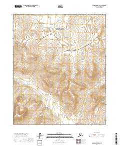
2017 Map of Bendeleben B-3 SW
USGS Topo · Published 2017About this map
Bering Land Bridge National Preserve dominates the northern landscape of this interior section of the Seward Peninsula, where high-latitude drainage patterns define the wilderness. The map captures the rugged transition from the low-lying valley of Boston Cr as it winds through the central township toward the rising elevations of the Bendeleben Mountains in the southeast. This 2017 study illustrates the complex topographic relief of a region shaped by ancient migration routes and modern conservation, showing a landscape largely devoid of human infrastructure but defined by its natural watercourses and the strict administrative boundaries of the public land survey system.
Find a feature on this map
13 named features on this map. Tap any name to fly to it.
Don’t see what you’re looking for? This feature index may not catch every label — zoom into the map to look around manually.
Map Details
Editions of this 2017 Bendeleben B-3 SW Map
This is the sole edition of this map. No revisions or reprints were ever made.
Other maps of this area

1950 · Bendeleben A-4
USGS Topo · 1:63,360

1950 · Bendeleben A-3
USGS Topo · 1:63,360

1950 · Bendeleben B-4
USGS Topo · 1:63,360

1950 · Bendeleben B-3
USGS Topo · 1:63,360

1950 · Bendeleben
USGS Topo · 1:250,000

1951 · Bendeleben
USGS Topo · 1:250,000

1964 · Bendeleben
USGS Topo · 1:250,000

1970 · Bendeleben A-4
USGS Topo · 1:63,360
2017 · Bendeleben A-4 NE
USGS Topo · 1:25,000
2017 · Bendeleben B-4 NE
USGS Topo · 1:25,000