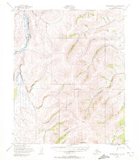
1950 Map of Bendeleben C-1
USGS Topo · Published 1972About this map
The Continental Divide cuts through this high-latitude terrain, separating the drainage systems of the Seward Peninsula. To the north, the headwaters of Candle Creek and Eldorado Creek flow toward the Arctic, while the western slopes feed the Kugruk River. The landscape is defined by the stark peaks of Monument Mountain and Kiwalik Mountain, serving as prominent landmarks for navigation in a region without permanent settlements. An extensive system of water management is visible through the Candle Ditch, which snakes across the contours to support hydraulic operations. Traces of historical movement and exploration are preserved here in the form of a Winter Trail and a Tel Line that traverse the eastern slopes, illustrating the remote infrastructure required to link these gold-bearing drainages like Gold Run and Bonanza Creek to the wider world.
Find a feature on this map
29 named features on this map. Tap any name to fly to it.
Don’t see what you’re looking for? This feature index may not catch every label — zoom into the map to look around manually.
Map Details
Editions of this 1950 Bendeleben C-1 Map
3 editions found
Other maps of this area

1950 · Bendeleben C-1
USGS Topo · 1:63,360

1950 · Bendeleben B-2
USGS Topo · 1:63,360

1950 · Bendeleben C-2
USGS Topo · 1:63,360

1950 · Bendeleben B-1
USGS Topo · 1:63,360

1950 · Bendeleben D-2
USGS Topo · 1:63,360

1950 · Bendeleben
USGS Topo · 1:250,000

1950 · Bendeleben D-1
USGS Topo · 1:63,360

1950 · Candle B-6
USGS Topo · 1:63,360

1950 · Candle C-6
USGS Topo · 1:63,360

1951 · Candle
USGS Topo · 1:250,000