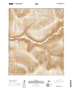
2017 Map of Bendeleben D-4 SW
USGS Topo · Published 2017About this map
The Bering Land Bridge National Preserve encompasses a vast portion of this terrain on the Seward Peninsula, preserving a landscape once central to the migration of people and wildlife to the Americas. The Goodhope River winds through the central portion of the map, serving as a primary drainage for the surrounding highlands. This area is defined by its complex network of seasonal and perennial waterways, including Esperanza Cr and Tallowpot Cr, which carve through the high-latitude tundra. The boundary between the Nome Census Area and Northwest Arctic Borough cuts across the southwestern corner, marking a rare administrative division in this largely uninhabited wilderness. The topography revealed by the 2017 survey emphasizes the intricate drainage patterns of the Lane Cr and Eagle Cr systems as they respond to the peninsula's unique geologic structure.
Find a feature on this map
15 named features on this map. Tap any name to fly to it.
Don’t see what you’re looking for? This feature index may not catch every label — zoom into the map to look around manually.
Map Details
Editions of this 2017 Bendeleben D-4 SW Map
This is the sole edition of this map. No revisions or reprints were ever made.
Other maps of this area

1950 · Bendeleben C-5
USGS Topo · 1:63,360

1950 · Bendeleben C-4
USGS Topo · 1:63,360

1950 · Bendeleben D-5
USGS Topo · 1:63,360

1950 · Bendeleben
USGS Topo · 1:250,000

1950 · Bendeleben D-4
USGS Topo · 1:63,360

1951 · Bendeleben
USGS Topo · 1:250,000

1964 · Bendeleben
USGS Topo · 1:250,000
2014 · Bendeleben D-5 NE
USGS Topo · 1:25,000
2014 · Bendeleben D-4 NW
USGS Topo · 1:25,000
2017 · Bendeleben D-5 SE
USGS Topo · 1:25,000