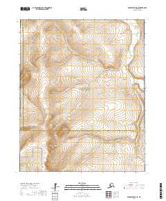
2017 Map of Bendeleben D-5 SE
USGS Topo · Published 2017About this map
The Bering Land Bridge National Preserve occupies the heart of this landscape, protecting a massive expanse of the Seward Peninsula. This 2017 survey captures a remote wilderness where drainage patterns define the geography, most notably the Goodhope River which flows through the northeastern corner. Smaller waterways like Little Daisy Cr and Placer Cr carve through the terrain, while the jurisdictional line between the Northwest Arctic Borough and the Nome Census Area bisects the southern half of the sheet. The map is a testament to the preservation of this unique ecosystem, showing a land largely devoid of modern infrastructure and maintained in its natural state.
Find a feature on this map
14 named features on this map. Tap any name to fly to it.
Don’t see what you’re looking for? This feature index may not catch every label — zoom into the map to look around manually.
Map Details
Editions of this 2017 Bendeleben D-5 SE Map
This is the sole edition of this map. No revisions or reprints were ever made.
Other maps of this area

1950 · Bendeleben C-5
USGS Topo · 1:63,360

1950 · Bendeleben C-4
USGS Topo · 1:63,360

1950 · Bendeleben D-5
USGS Topo · 1:63,360

1950 · Bendeleben
USGS Topo · 1:250,000

1950 · Bendeleben D-4
USGS Topo · 1:63,360

1951 · Bendeleben
USGS Topo · 1:250,000

1964 · Bendeleben
USGS Topo · 1:250,000
2014 · Bendeleben D-5 NW
USGS Topo · 1:25,000
2014 · Bendeleben D-5 SW
USGS Topo · 1:25,000
2014 · Bendeleben C-5 NW
USGS Topo · 1:25,000