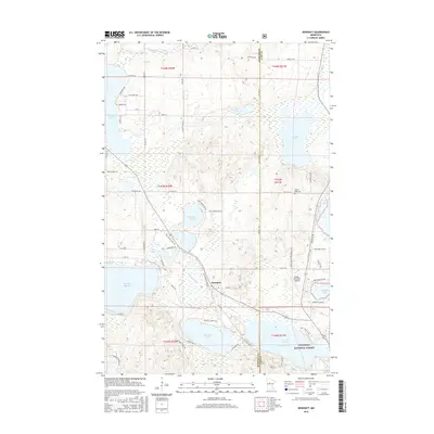
2016 Map of Benedict
USGS Topo · Published 2016About this map
The Chippewa National Forest surrounds the small settlement of Benedict, where the Kabekona River flows into Benedict Lake. This Northwoods landscape is defined by its dense hydrology, featuring Leech Lake in the southeast and the winding Necktie River to the north. The area shows a transition from recreational water access to managed timberlands, with the Paul Bunyan State Trl and Heartland Trl carving paths through the forest for modern-day transit. Local history is anchored by the Golden Gate Cem near the junction of t143n r31w and t143n r32w. The mapping of small airfields like Robco Airport and Walker Municipal Airport highlights the region's role as a destination for seasonal residents and aviators exploring the various bays, including Kabekona Bay and Welshes Bay.
Find a feature on this map
56 named features on this map. Tap any name to fly to it.
Don’t see what you’re looking for? This feature index may not catch every label — zoom into the map to look around manually.
Map Details
Editions of this 2016 Benedict Map
This is the sole edition of this map. No revisions or reprints were ever made.
Other maps of this area

1954 · Bemidji
USGS Topo · 1:250,000

1957 · Bemidji
USGS Topo · 1:250,000

1958 · Bemidji
USGS Topo · 1:250,000

1968 · Guthrie
USGS Topo · 1:24,000

1972 · Steamboat Bay
USGS Topo · 1:24,000
1972 · East Crooked Lake
USGS Topo · 1:24,000

1972 · Benedict
USGS Topo · 1:24,000

1972 · Laporte
USGS Topo · 1:24,000

1972 · Pike Bay
USGS Topo · 1:24,000
1972 · Akeley
USGS Topo · 1:24,000