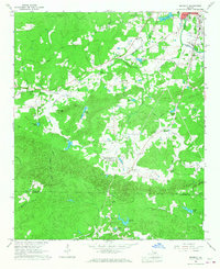
1966 Map of Benedict
USGS Topo · Published 1967About this map
Treat Mountain and Dugdown Mountain dominate the southern landscape of this mid-1960s survey, where the boundary between Polk and Haralson counties follows the high ridgelines. The northern reaches show a more developed rural character, anchored by the Seaboard Coast Line railroad and the small settlement of Benedict. This era captures a network of country churches and schools that served the surrounding agricultural and timber lands, including the Blooming Grove Ch near Fullwood Springs and the Brewster Sch along the rail line. Small-scale aviation and industry are evidenced by a Landing Strip near Johnson Lake and a prominent Substation. Water features like Pumpkin Pile Creek and Cedar Creek wind through the valleys, supporting numerous small impoundments such as Pettit Lake and Vance Lake, which reflect the localized land management and recreation patterns of the period.
Find a feature on this map
55 named features on this map. Tap any name to fly to it.
Don’t see what you’re looking for? This feature index may not catch every label — zoom into the map to look around manually.
Map Details
Editions of this 1966 Benedict Map
2 editions found
Other maps of this area

1886 · Rome
USGS Topo · 1:125,000

1889 · Tallapoosa
USGS Topo · 1:125,000

1892 · Tallapoosa
USGS Topo · 1:125,000

1897 · Tallapoosa
USGS Topo · 1:125,000

1898 · Rome
USGS Topo · 1:125,000

1899 · Rome
USGS Topo · 1:125,000

1904 · Rome
USGS Topo · 1:125,000

1953 · Atlanta
USGS Topo · 1:250,000

1955 · Rome
USGS Topo · 1:250,000

1957 · Atlanta
USGS Topo · 1:250,000