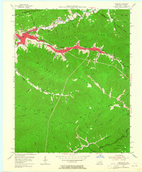
1954 Map of Benham
USGS Topo · Published 1964About this map
Cumberland, Benham, and Lynch anchor this 1950s survey of Harlan County’s coal-producing heartland. The industrial footprint of the era is evident in the dense residential blocks of the coal camps and the prominent path of the Louisville and Nashville railroad as it follows Looney Creek through the narrow valley. This transportation corridor connects the major settlements to specialized facilities like the Lynch High Sch and the regional Cawood Sch.
Find a feature on this map
33 named features on this map. Tap any name to fly to it.
Don’t see what you’re looking for? This feature index may not catch every label — zoom into the map to look around manually.
Map Details
Editions of this 1954 Benham Map
4 editions found
Other maps of this area

1887 · Jonesville
USGS Topo · 1:125,000

1890 · Whitesburg
USGS Topo · 1:125,000

1891 · Hazard
USGS Topo · 1:125,000

1891 · Jonesville
USGS Topo · 1:125,000

1892 · Whitesburg
USGS Topo · 1:125,000

1894 · Estillville
USGS Topo · 1:125,000

1913 · Oven Fork
USGS Topo · 1:48,000

1915 · Whitesburg
USGS Topo · 1:62,500

1916 · Cornettsville
USGS Topo · 1:62,500

1916 · Nolansburg
USGS Topo · 1:48,000