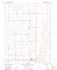
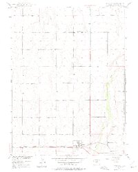
1949 Map of Bennett
USGS Topo · Published 1986About this map
Bennett serves as the primary hub of this eastern Adams County landscape, anchored by the Union Pacific railroad and the historic path of the Old Victory Highway. The settlement pattern follows the drainage of the high plains, with Lost Sand Creek and Kiowa Creek cutting through the terrain. To the north, the small community of Central Valley is centered around the Central Valley Sch, illustrating the mid-century rural school system before consolidation. Local infrastructure includes the Bennett Cem and a nearby Gravel Pit south of the main town site, while the grid of Irondale Road and section lines organizes the agricultural land. This survey, based on 1948 photography, captures the area during the post-war development of the Missouri River Basin project.
Find a feature on this map
12 named features on this map. Tap any name to fly to it.
Don’t see what you’re looking for? This feature index may not catch every label — zoom into the map to look around manually.
Map Details
Editions of this 1949 Bennett Map
6 editions found
Other maps of this area

1890 · East Denver
USGS Topo · 1:125,000

1949 · Sunnydale
USGS Topo · 1:24,000

1949 · Bennett
USGS Topo · 1:24,000

1950 · Roper School
USGS Topo · 1:24,000

1951 · Roper School
USGS Topo · 1:24,000

1951 · Living Springs
USGS Topo · 1:24,000

1951 · Manila
USGS Topo · 1:24,000
1952 · Horse Creek
USGS Topo · 1:24,000

1953 · Denver
USGS Topo · 1:250,000

1954 · Watkins
USGS Topo · 1:24,000