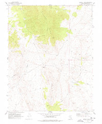
1970 Map of Bennett Pass
USGS Topo · Published 1978About this map
The Pan American Mine sits at the northern edge of this high-desert landscape, reflecting the mining activity that has long shaped the eastern Nevada interior. The area is dominated by the massive crests of the Highland Range, Chief Range, and the Black Canyon Range, where elevation and terrain dictate the path of travel. Steep drainage systems like Deer Canyon and Black Canyon carve through the limestone and volcanic rock, feeding into lower areas such as Oak Flat.
Find a feature on this map
16 named features on this map. Tap any name to fly to it.
Don’t see what you’re looking for? This feature index may not catch every label — zoom into the map to look around manually.
Map Details
Editions of this 1970 Bennett Pass Map
2 editions found
Other maps of this area

1885 · Pioche
USGS Topo · 1:250,000

1886 · Pioche
USGS Topo · 1:250,000

1916 · Highland
USGS Topo · 1:62,500

1918 · Highland
USGS Topo · 1:62,500

1921 · NW 1/4 Panaca
USGS Topo · 1:48,000

1953 · Highland Peak
USGS Topo · 1:24,000

1953 · Pioche
USGS Topo · 1:24,000

1954 · Caliente
USGS Topo · 1:250,000

1959 · Caliente
USGS Topo · 1:250,000
1970 · The Bluffs
USGS Topo · 1:24,000