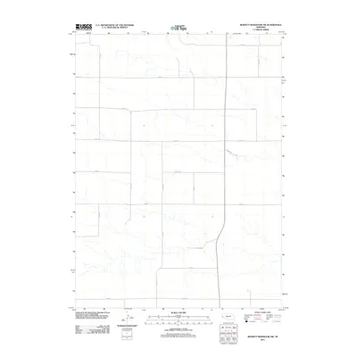
2011 Map of Bennett Reservoir NW
USGS Topo · Published 2011About this map
Banner County, Nebraska, is defined by a sparse, geometric grid of rural routes that segment the High Plains landscape in this 2011 survey. The territory is characterized by its isolation and the systematic layout of county roads such as Co Rd 10 and Road 14, which traverse the open range. Watercourses here are intermittent and ephemeral, carving subtle drainage patterns across the terrain between major thoroughfares like Co Rd 35 and Road 45. This map reveals the modern infrastructure of a ranching and agricultural region where travel is dictated by long, straight stretches including Co Rd 110 and Co Rd 54. The settlement pattern is minimal, with the map focusing primarily on the network of county-maintained pathways that connect this portion of the Nebraska Panhandle.
Find a feature on this map
18 named features on this map. Tap any name to fly to it.
Don’t see what you’re looking for? This feature index may not catch every label — zoom into the map to look around manually.
Map Details
Editions of this 2011 Bennett Reservoir NW Map
This is the sole edition of this map. No revisions or reprints were ever made.
Other maps of this area

1898 · Scotts Bluff
USGS Topo · 1:125,000

1954 · Scottsbluff
USGS Topo · 1:250,000

1958 · Scottsbluff
USGS Topo · 1:250,000

1973 · Kimball 2 NE
USGS Topo · 1:24,000

1973 · Scotts Bluff 4 SE
USGS Topo · 1:24,000

1973 · Kimball 2 SE
USGS Topo · 1:24,000

1973 · Kimball 1 SE
USGS Topo · 1:24,000

1973 · Scotts Bluff 4 SW
USGS Topo · 1:24,000

1973 · Scotts Bluff 3 SE
USGS Topo · 1:24,000

1973 · Kimball 1 NE
USGS Topo · 1:24,000