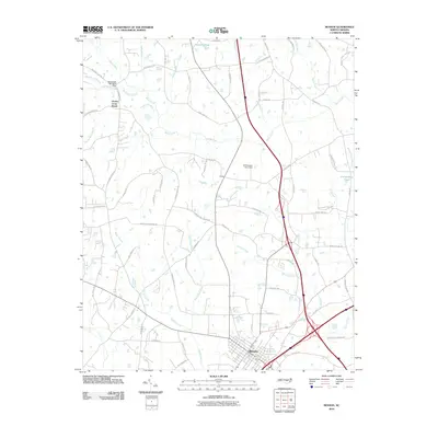
2010 Map of Benson
USGS Topo · Published 2010About this map
Benson serves as the primary hub in this Johnston County landscape, situated at a major crossroads during the first decade of the 21st century. The map reveals a transition from traditional rural land use to modern infrastructure, where major transportation corridors intersect near local landmarks. The drainage network is particularly detailed, defined by Mingo Swamp and East Mingo Creek to the south, while Black Creek and Hannah Creek wind through the central and northern sections. Family names and local history are preserved in labels like the Massengill Mill Pond Dam and G R Barbour Pond. Small historic settlements and junctions such as Hardee Cross Roads, Macks, and Allens Crossroads indicate the distributed nature of the community before the further expansion of regional road networks.
Find a feature on this map
65 named features on this map. Tap any name to fly to it.
Don’t see what you’re looking for? This feature index may not catch every label — zoom into the map to look around manually.
Map Details
Editions of this 2010 Benson Map
This is the sole edition of this map. No revisions or reprints were ever made.
Other maps of this area

1906 · Four Oaks
USGS Topo · 1:48,000

1908 · Four Oaks
USGS Topo · 1:62,500

1953 · Raleigh
USGS Topo · 1:250,000

1954 · Raleigh
USGS Topo · 1:250,000

1964 · Selma
USGS Topo · 1:62,500

1964 · Angier
USGS Topo · 1:24,000

1964 · Edmondson
USGS Topo · 1:24,000

1964 · Garner
USGS Topo · 1:62,500

1964 · Powhatan
USGS Topo · 1:24,000

1973 · Benson
USGS Topo · 1:24,000