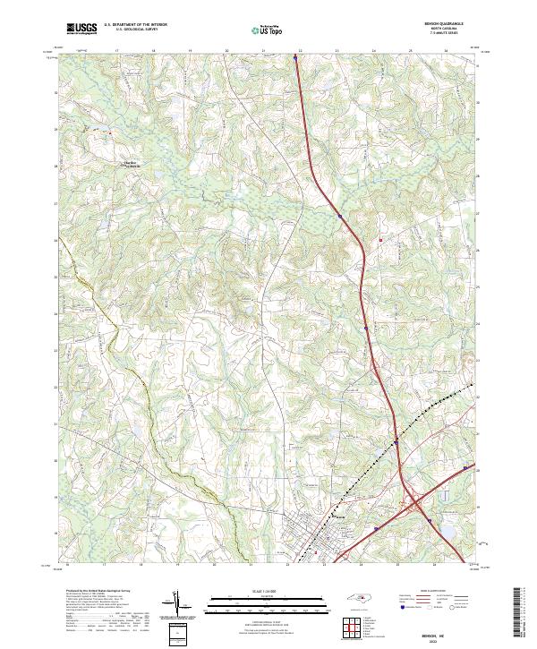
2022 Map of Benson
USGS Topo · Published 2022About this map
Benson serves as the primary municipal hub in this portion of the coastal plain, situated along a vital transportation corridor where North Carolina's rural agricultural lands meet modern interstate development. The town's grid is dense with named streets, contrasting with the surrounding landscape of winding tributaries and family-named homesteads. To the northwest, the intersection at Hardee Cross Roads marks a distinct rural node, while the county line between Johnston Co and Harnett Co runs through the southwestern reaches of the map.
Find a feature on this map
134 named features on this map. Tap any name to fly to it.
Don’t see what you’re looking for? This feature index may not catch every label — zoom into the map to look around manually.
Map Details
Editions of this 2022 Benson Map
This is the sole edition of this map. No revisions or reprints were ever made.
Other maps of this area

1906 · Four Oaks
USGS Topo · 1:48,000

1908 · Four Oaks
USGS Topo · 1:62,500

1953 · Raleigh
USGS Topo · 1:250,000

1954 · Raleigh
USGS Topo · 1:250,000

1964 · Selma
USGS Topo · 1:62,500

1964 · Angier
USGS Topo · 1:24,000

1964 · Edmondson
USGS Topo · 1:24,000

1964 · Garner
USGS Topo · 1:62,500

1964 · Powhatan
USGS Topo · 1:24,000

1973 · Benson
USGS Topo · 1:24,000