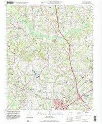
1997 Map of Benson
USGS Topo · Published 2000About this map
Benson serves as the focal point of this Johnston County landscape, situated at a major highway intersection just before the turn of the 21st century. The map reveals a dense network of rural community landmarks, particularly country churches like St Marys Grove, Benson Grove Ch, and Johnsons Chapel that anchor the surrounding farmland. The topography is defined by the winding paths of Mingo Creek and Hannah Creek, alongside the expansive Johnston Co Harnett Co Swamp at the southwestern boundary.
Find a feature on this map
41 named features on this map. Tap any name to fly to it.
Don’t see what you’re looking for? This feature index may not catch every label — zoom into the map to look around manually.
Map Details
Editions of this 1997 Benson Map
This is the sole edition of this map. No revisions or reprints were ever made.
Other maps of this area

1906 · Four Oaks
USGS Topo · 1:48,000

1908 · Four Oaks
USGS Topo · 1:62,500

1953 · Raleigh
USGS Topo · 1:250,000

1954 · Raleigh
USGS Topo · 1:250,000

1964 · Selma
USGS Topo · 1:62,500

1964 · Angier
USGS Topo · 1:24,000

1964 · Edmondson
USGS Topo · 1:24,000

1964 · Garner
USGS Topo · 1:62,500

1964 · Powhatan
USGS Topo · 1:24,000

1973 · Benson
USGS Topo · 1:24,000