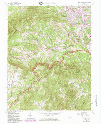
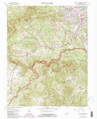
1963 Map of Bent Mountain
USGS Topo · Published 1984About this map
Bent Mountain towers over the headwaters of the Roanoke River, serving as a prominent landmark in this 1960s survey that documents the transition from rural highlands to the expanding suburban fringe of Roanoke. The Blue Ridge Parkway winds along the crests, connecting gaps like Lancaster Gap and Slings Gap, while the valley floor is defined by long-standing agricultural and industrial sites such as Poages Mill. To the northeast, the growth of Cave Spring is visible through its evolving school system, including Cave Spring High Sch and Oak Grove Sch.
Find a feature on this map
52 named features on this map. Tap any name to fly to it.
Don’t see what you’re looking for? This feature index may not catch every label — zoom into the map to look around manually.
Map Details
Editions of this 1963 Bent Mountain Map
5 editions found
Other maps of this area

1890 · Roanoke
USGS Topo · 1:125,000

1890 · Christiansburg
USGS Topo · 1:125,000

1891 · Roanoke
USGS Topo · 1:125,000

1929 · Roanoke
USGS Topo · 1:48,000

1929 · Salem
USGS Topo · 1:48,000

1932 · Salem
USGS Topo · 1:62,500

1933 · Roanoke
USGS Topo · 1:62,500

1947 · Roanoke
USGS Topo · 1:250,000

1950 · Elliston
USGS Topo · 1:62,500

1951 · Boones Mill
USGS Topo · 1:62,500