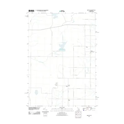
2011 Map of Bentley
USGS Topo · Published 2011About this map
Bentley and Rhodes anchor this portion of Gladwin County, marking a landscape defined by small-town infrastructure and water management. The Molasses River Flooding Number Three and the Little Molasses River dominate the central drainage, while Saganing Creek and Fish Creek cross the eastern and western peripheries. This 2011 survey records the essential rural landmarks that define these communities, including the Bentley Post Office and Rhodes Post Office. Local family and community history is preserved through the locations of several burial grounds, such as Bentley Cemetery, Rhodes Cemetery, and Hope Lutheran Cemetery. The road network, from major arteries like Standish Rd to the more utilitarian Center Firelane Trl, reflects a structured grid that has organized the township’s agriculture and forestry for generations.
Find a feature on this map
35 named features on this map. Tap any name to fly to it.
Don’t see what you’re looking for? This feature index may not catch every label — zoom into the map to look around manually.
Map Details
Editions of this 2011 Bentley Map
This is the sole edition of this map. No revisions or reprints were ever made.
Other maps of this area

1954 · Traverse City
USGS Topo · 1:250,000

1954 · Midland
USGS Topo · 1:250,000

1958 · Traverse City
USGS Topo · 1:250,000

1958 · Midland
USGS Topo · 1:250,000

1959 · Midland
USGS Topo · 1:250,000

1966 · Midland
USGS Topo · 1:250,000
1967 · Mount Forest
USGS Topo · 1:24,000
1967 · Crump
USGS Topo · 1:24,000

1968 · Sterling
USGS Topo · 1:24,000

1968 · Sterling SW
USGS Topo · 1:24,000