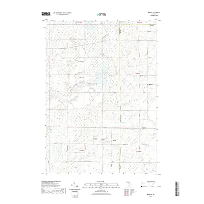
2019 Map of Bentley
USGS Topo · Published 2019About this map
The lowlands of Bentley Marsh and the winding course of the Little Molasses River define this corner of Gladwin, Bay, and Arenac Counties. In the southern portion of the sheet, the small settlement of Rhodes serves as a local focal point near the intersection of several township roads. This area is characterized by a high density of rural burial grounds, including Rhodes Cem, New Rhodes Cem, and the Hope Lutheran Cem located further south. To the northeast, the community of Bentley sits near the Bentley Cem, surrounded by a landscape of drainage ditches like Gear Drain and County Drain. The mapping of numerous fire lanes and trails, such as the E Center Fire Lane Trl and Guernsey Creek Trl, suggests a region managed for timber or natural resources, where the grid of the Public Land Survey System meets the irregular boundaries of Michigan's wetlands.
Find a feature on this map
52 named features on this map. Tap any name to fly to it.
Don’t see what you’re looking for? This feature index may not catch every label — zoom into the map to look around manually.
Map Details
Editions of this 2019 Bentley Map
This is the sole edition of this map. No revisions or reprints were ever made.
Other maps of this area

1954 · Traverse City
USGS Topo · 1:250,000

1954 · Midland
USGS Topo · 1:250,000

1958 · Traverse City
USGS Topo · 1:250,000

1958 · Midland
USGS Topo · 1:250,000

1959 · Midland
USGS Topo · 1:250,000

1966 · Midland
USGS Topo · 1:250,000
1967 · Mount Forest
USGS Topo · 1:24,000
1967 · Crump
USGS Topo · 1:24,000

1968 · Sterling
USGS Topo · 1:24,000

1968 · Sterling SW
USGS Topo · 1:24,000