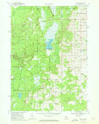
1969 Map of Bentley
USGS Topo · Published 1972About this map
The Grim State Forest dominates the western half of this landscape, where the waters of the Tittabawassee River and Little Molasses River flow through a low-lying terrain of wetlands and timber. In the center, the Molasses River Flooding No 3 and its associated Spillway Elev 747 reflect mid-century water management efforts. Small farming and timber communities like Bentley and Rhodes anchor the eastern section, where the grid of section roads meets the natural drainage of Saganing Creek and Guernsey Creek.
Find a feature on this map
33 named features on this map. Tap any name to fly to it.
Don’t see what you’re looking for? This feature index may not catch every label — zoom into the map to look around manually.
Map Details
Editions of this 1969 Bentley Map
This is the sole edition of this map. No revisions or reprints were ever made.
Other maps of this area

1954 · Traverse City
USGS Topo · 1:250,000

1954 · Midland
USGS Topo · 1:250,000

1958 · Traverse City
USGS Topo · 1:250,000

1958 · Midland
USGS Topo · 1:250,000

1959 · Midland
USGS Topo · 1:250,000

1966 · Midland
USGS Topo · 1:250,000
1967 · Mount Forest
USGS Topo · 1:24,000
1967 · Crump
USGS Topo · 1:24,000

1968 · Sterling
USGS Topo · 1:24,000

1968 · Sterling SW
USGS Topo · 1:24,000