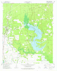
1975 Map of Benton
USGS Topo · Published 1978About this map
Benton serves as the focal point of this mid-1970s landscape, featuring its prominent Courthouse and the Benton Oil and Gas Field to the northeast. The geography is fundamentally defined by the Cypress Bayou Reservoir, which appears here during its formative years with a Cypress Bayou Dam and areas marked as under construction. This expansion of the reservoir over Cypress Bayou significantly altered the local environment, inundating previous creek-side features while preserving a network of cemeteries like Raymond Cem and Sibley Cem on its rising shores.
Find a feature on this map
53 named features on this map. Tap any name to fly to it.
Don’t see what you’re looking for? This feature index may not catch every label — zoom into the map to look around manually.
Map Details
Editions of this 1975 Benton Map
3 editions found
Other maps of this area

1932 · Bossier SE
USGS Topo · 1:31,680

1932 · Bossier NE
USGS Topo · 1:31,680

1932 · Bossier SW
USGS Topo · 1:31,680

1932 · Shreveport SE
USGS Topo · 1:31,680

1932 · Hosston SE
USGS Topo · 1:31,680

1932 · Bossier NW
USGS Topo · 1:31,680

1932 · Shreveport NE
USGS Topo · 1:31,680

1948 · Mooringsport
USGS Topo · 1:62,500

1948 · Vivian
USGS Topo · 1:62,500

1948 · Bossier City
USGS Topo · 1:62,500