1975 Map of Bossier City NW
USGS Topo · Published 1976About this map
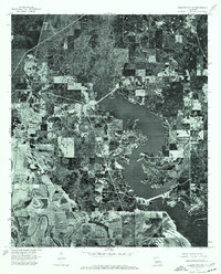
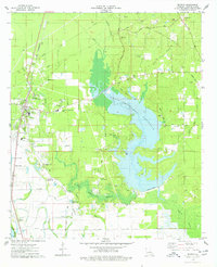
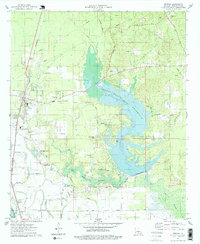
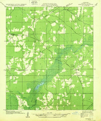
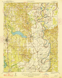
Benton serves as the focal point of this 1975 orthophotograph, situated in a region defined by the winding course of the Red R. This aerial perspective provides a unique view of the landscape before significant modern expansion, revealing the dense woodlands and cleared agricultural plots that characterized Bossier Parish in the mid-1970s. The image clearly shows the transition from the river bottomlands to the upland areas, where a large, irregular reservoir dominates the eastern half of the sheet. By capturing the physical layout of the land during this period, the map allows for the study of historical land use and the specific environmental footprints of regional water management projects as they appeared nearly fifty years ago.
Find a feature on this map
2 named features on this map. Tap any name to fly to it.
Don’t see what you’re looking for? This feature index may not catch every label — zoom into the map to look around manually.
Map Details
Editions of this 1975 Bossier City NW Map
3 editions found
Other maps of this area
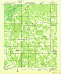
1932 · Bossier SE
USGS Topo · 1:31,680
1932 · Bossier NE
USGS Topo · 1:31,680
1932 · Bossier SW
USGS Topo · 1:31,680

1932 · Shreveport SE
USGS Topo · 1:31,680

1932 · Hosston SE
USGS Topo · 1:31,680
1932 · Bossier NW
USGS Topo · 1:31,680

1932 · Shreveport NE
USGS Topo · 1:31,680
1948 · Mooringsport
USGS Topo · 1:62,500
1948 · Vivian
USGS Topo · 1:62,500
1948 · Bossier City
USGS Topo · 1:62,500