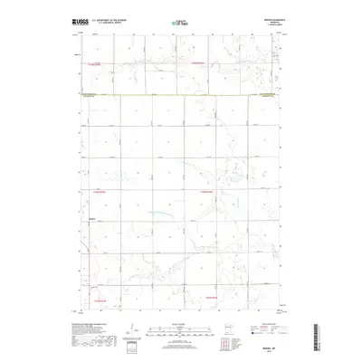
2019 Map of Bergen
USGS Topo · Published 2019About this map
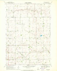
Bergen serves as the central settlement point in this agrarian landscape along the boundary of Cottonwood and Jackson counties. The terrain is defined by its complex drainage network, where the S Fork Watonwan River flows across the northern sections while Elm Cr and the N Fork Elm Cr manage the southern watersheds. These natural watercourses are supplemented by engineered waterways such as Judicial Ditch Number Thirtythree, illustrating the intensive management of the land for cultivation. In the southwestern corner near 540 Ave, Hauges Cem stands as a significant point for genealogical research, anchoring the history of local families to this specific township. The rigid grid of section lines and county roads, including Co Hwy 36, dictates the movement and development patterns of this rural Minnesota region.
Find a feature on this map
41 named features on this map. Tap any name to fly to it.
Don’t see what you’re looking for? This feature index may not catch every label — zoom into the map to look around manually.
Map Details
Editions of this 2019 Bergen Map
This is the sole edition of this map. No revisions or reprints were ever made.
Other maps of this area

1954 · Fairmont
USGS Topo · 1:250,000

1958 · Fairmont
USGS Topo · 1:250,000

1970 · Jackson NW
USGS Topo · 1:24,000
1970 · Butterfield
USGS Topo · 1:24,000

1970 · Lakefield NE
USGS Topo · 1:24,000
1970 · Bingham Lake
USGS Topo · 1:24,000

1970 · Mountain Lake SE
USGS Topo · 1:24,000
1970 · Mountain Lake
USGS Topo · 1:24,000

1970 · Windom
USGS Topo · 1:24,000
1970 · Bergen
USGS Topo · 1:24,000