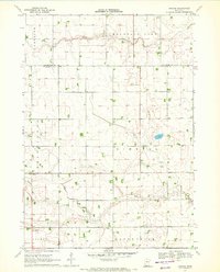
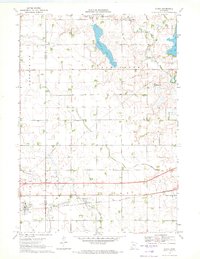
1970 Map of Bergen
USGS Topo · Published 1972About this map
Bergen serves as a central point of reference in this agricultural region of southern Minnesota, where the landscape is meticulously carved by a complex network of waterways and drainage improvements. The South Fork Watonwan River and North Fork Watonwan River meander through the northern portion of the quadrangle, while Elm Creek flows through the southern reaches. The implementation of Judicial Ditch No 13 underscores the era's focus on land management and water control for farming. Local landmarks provide essential touchstones for genealogists and local historians, including the Hauger Cem in Belmont and a local Townhall situated near the intersection of Kimball and Enterprise townships. This 1970 field-checked survey also details the section lines and field boundaries, often marked by fences visible from aerial photography, that define the rural grid of the day.
Find a feature on this map
15 named features on this map. Tap any name to fly to it.
Don’t see what you’re looking for? This feature index may not catch every label — zoom into the map to look around manually.
Map Details
Editions of this 1970 Bergen Map
This is the sole edition of this map. No revisions or reprints were ever made.
Other maps of this area

1954 · Fairmont
USGS Topo · 1:250,000

1958 · Fairmont
USGS Topo · 1:250,000

1970 · Jackson NW
USGS Topo · 1:24,000
1970 · Butterfield
USGS Topo · 1:24,000

1970 · Lakefield NE
USGS Topo · 1:24,000
1970 · Bingham Lake
USGS Topo · 1:24,000

1970 · Mountain Lake SE
USGS Topo · 1:24,000
1970 · Mountain Lake
USGS Topo · 1:24,000

1970 · Windom
USGS Topo · 1:24,000
1970 · Alpha
USGS Topo · 1:24,000