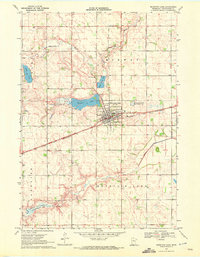
1970 Map of Mountain Lake
USGS Topo · Published 1972About this map
Mountain Lake serves as the focal point of this Cottonwood County landscape, where the town site is tightly integrated with the Chicago and North Western rail line. The town's layout and surrounding rural townships, including Midway, Carson, and Lakeside, reveal a classic Midwestern agricultural grid punctuated by essential local institutions like the Mennonite Cem. The presence of the Mountain Lake State Wildlife Management Area and Bennett State Wildlife Management Area suggests a significant regional commitment to conservation and waterfowl habitat during this era.
Find a feature on this map
16 named features on this map. Tap any name to fly to it.
Don’t see what you’re looking for? This feature index may not catch every label — zoom into the map to look around manually.
Map Details
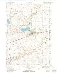
Editions of this 1970 Mountain Lake Map
2 editions found
Other maps of this area

1953 · New Ulm
USGS Topo · 1:250,000

1954 · Fairmont
USGS Topo · 1:250,000

1957 · New Ulm
USGS Topo · 1:250,000

1958 · New Ulm
USGS Topo · 1:250,000

1958 · Fairmont
USGS Topo · 1:250,000

1967 · New Ulm
USGS Topo · 1:250,000

1967 · Sanborn SE
USGS Topo · 1:24,000

1967 · Darfur
USGS Topo · 1:24,000
1967 · Comfrey
USGS Topo · 1:24,000
1970 · Butterfield
USGS Topo · 1:24,000