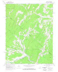
1967 Map of Bergton
USGS Topo · Published 1976About this map
Bergton sits at the confluence of several mountain drainage systems in the late 1960s, serving as a local hub near the West Virginia Virginia state line. The landscape is defined by the high ridges of Flattop Mountain and Fallbush Mountain, while human activity centers around the Crab Run and North Fork Shenandoah River valleys. Local life and genealogy are reflected in the numerous rural institutions, including Jenkins Chapel, Martin Luther Ch, and the Bergton Sch.
Find a feature on this map
49 named features on this map. Tap any name to fly to it.
Don’t see what you’re looking for? This feature index may not catch every label — zoom into the map to look around manually.
Map Details
Editions of this 1967 Bergton Map
4 editions found
Other maps of this area

1892 · Franklin
USGS Topo · 1:125,000

1892 · Woodstock
USGS Topo · 1:125,000

1896 · Franklin
USGS Topo · 1:125,000

1920 · Petersburg
USGS Topo · 1:48,000

1921 · Orkney Springs
USGS Topo · 1:48,000

1921 · Petersburg
USGS Topo · 1:48,000

1922 · Fort Seybert
USGS Topo · 1:48,000

1922 · Petersburg
USGS Topo · 1:62,500

1923 · Orkney Springs
USGS Topo · 1:62,500

1924 · Fort Seybert
USGS Topo · 1:62,500