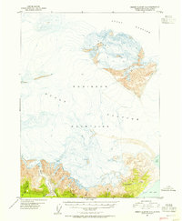
1951 Map of Bering Glacier A-2
USGS Topo · Published 1958About this map
Guyot Glacier dominates this landscape in the early 1950s, its massive icy expanse flowing toward the waters of Icy Bay. The terrain is defined by the high elevations of the Robinson Mountains and the Guyot Hills, where the ice begins to break into distinct lobes and smaller glaciers. Based on aerial photography from 1948, the topography reveals a dynamic environment where water and ice meet, seen in the movement of the Beare Glacier and the drainage of the Big River.
Find a feature on this map
11 named features on this map. Tap any name to fly to it.
Don’t see what you’re looking for? This feature index may not catch every label — zoom into the map to look around manually.
Map Details
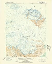
Editions of this 1951 Bering Glacier A-2 Map
3 editions found
Other maps of this area

1948 · Icy Bay D-2 and D-3
USGS Topo · 1:63,360

1950 · Bering Glacier A-3
USGS Topo · 1:63,360

1950 · Bering Glacier
USGS Topo · 1:250,000

1950 · Icy Bay
USGS Topo · 1:250,000

1951 · Icy Bay D-2 and D-3
USGS Topo · 1:63,360

1951 · Icy Bay
USGS Topo · 1:250,000

1951 · Bering Glacier
USGS Topo · 1:250,000

1951 · Bering Glacier A-2
USGS Topo · 1:63,360
1959 · Icy Bay D-2 and D-3
USGS Topo · 1:63,360

1959 · Bering Glacier
USGS Topo · 1:250,000