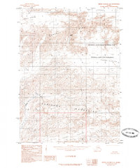
1985 Map of Bering Glacier B-4
USGS Topo · Published 1985About this map
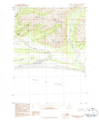
Wrangell-Saint Elias National Park dominates this 1985 provisional study, revealing a landscape defined by massive glacial systems and high mountain ridges. The sheet provides a detailed view of the Bering Glacier as it interacts with the Bagley Icefield to the north and the Yahtse Glacier to the east. This specialized topographic record, compiled from aerial photography taken in the early 1970s, captures the complex glacial morphology before more recent shifts in ice volume. Notable terrestrial features include the Robinson Mountains and Barkley Ridge, which segment the ice-choked valleys. Along the southern reaches, the Duktoth River Sand appears as a rare break in the ice, where glacial meltwater begins to organize into alluvial patterns. The inclusion of the Wrangell-Saint Elias Wilderness designation reflects the mid-1980s era of federal land management in this remote corner of Alaska.
Find a feature on this map
9 named features on this map. Tap any name to fly to it.
Don’t see what you’re looking for? This feature index may not catch every label — zoom into the map to look around manually.
Map Details
Editions of this 1985 Bering Glacier B-4 Map
This is the sole edition of this map. No revisions or reprints were ever made.
Other maps of this area

1948 · Bering Glacier A-4
USGS Topo · 1:63,360

1950 · Bering Glacier A-3
USGS Topo · 1:63,360

1950 · Bering Glacier
USGS Topo · 1:250,000

1951 · Bering Glacier
USGS Topo · 1:250,000
1951 · Bering Glacier A-4
USGS Topo · 1:63,360

1959 · Bering Glacier
USGS Topo · 1:250,000
1959 · Bering Glacier A-3
USGS Topo · 1:63,360
1959 · Bering Glacier A-4
USGS Topo · 1:63,360
1984 · Bering Glacier A-5
USGS Topo · 1:63,360
1984 · Bering Glacier A-4
USGS Topo · 1:63,360