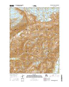
2016 Map of Bering Glacier B-5 SE
USGS Topo · Published 2016About this map
Bering Glacier dominates the northern reaches of this coastal Alaskan landscape, its icy expanse giving way to a network of high-relief ridges and glacial valleys. The flow of water and ice is the defining force here, seen in the braided paths of the Kulthieth River as it winds through the southwestern terrain and the Duktoth River on the eastern edge. This sheet offers a meticulous study of topographical change in a wilderness area defined by moving ice and shifting riverbeds, where the natural boundaries of the Bering Glacier interact with the underlying landforms. The absence of human settlements or infrastructure emphasizes the raw geological character of this remote corridor within the Yakutat region.
Find a feature on this map
8 named features on this map. Tap any name to fly to it.
Don’t see what you’re looking for? This feature index may not catch every label — zoom into the map to look around manually.
Map Details
Editions of this 2016 Bering Glacier B-5 SE Map
This is the sole edition of this map. No revisions or reprints were ever made.
Other maps of this area

1948 · Bering Glacier A-4
USGS Topo · 1:63,360

1950 · Bering Glacier
USGS Topo · 1:250,000

1951 · Bering Glacier
USGS Topo · 1:250,000
1951 · Bering Glacier A-4
USGS Topo · 1:63,360

1959 · Bering Glacier
USGS Topo · 1:250,000
1959 · Bering Glacier A-4
USGS Topo · 1:63,360
1984 · Bering Glacier A-5
USGS Topo · 1:63,360
1984 · Bering Glacier A-4
USGS Topo · 1:63,360
1985 · Bering Glacier B-5
USGS Topo · 1:63,360
1985 · Bering Glacier B-4
USGS Topo · 1:63,360