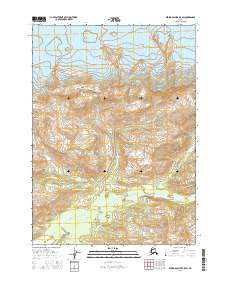
2016 Map of Bering Glacier B-5 SW
USGS Topo · Published 2016About this map
Bering Glacier dominates the northern landscape of this region in the Yakutat area of Alaska. The icy expanse gives way to the high elevation of the Sint Hills in the central portion of the map, illustrating the dramatic transition from glacial flow to uplifted terrain. To the south, the Kulthieth River winds through the Robinson Mountains, carving a path through the wilderness. This survey demonstrates the complex interaction between glacial recession and mountain hydrology in a remote Alaskan corridor, where the massive ice sheet has historically shaped the very foundation of the land and its drainage patterns.
Find a feature on this map
7 named features on this map. Tap any name to fly to it.
Don’t see what you’re looking for? This feature index may not catch every label — zoom into the map to look around manually.
Map Details
Editions of this 2016 Bering Glacier B-5 SW Map
This is the sole edition of this map. No revisions or reprints were ever made.
Other maps of this area

1950 · Bering Glacier
USGS Topo · 1:250,000

1951 · Bering Glacier
USGS Topo · 1:250,000

1959 · Bering Glacier
USGS Topo · 1:250,000
1984 · Bering Glacier A-6
USGS Topo · 1:63,360
1984 · Bering Glacier A-5
USGS Topo · 1:63,360
1985 · Bering Glacier B-5
USGS Topo · 1:63,360
1985 · Bering Glacier B-6
USGS Topo · 1:63,360
2016 · Bering Glacier B-5 NE
USGS Topo · 1:25,000
2016 · Bering Glacier A-6 NE
USGS Topo · 1:25,000
2016 · Bering Glacier B-6 NE
USGS Topo · 1:25,000