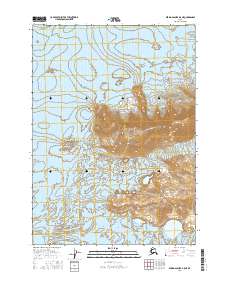
2016 Map of Bering Glacier B-5 NE
USGS Topo · Published 2016About this map
Chugach Mountains peaks dominate the northern elevation of this landscape, descending sharply into the massive expanse of the Bering Glacier. This 2016 survey provides a precise view of the glacial terminus and the complex meltwater patterns developing as the ice recedes toward the coast. To the southeast, the high terrain of Barkley Ridge defines the boundary between active ice flows and the surrounding mountain wilderness. The map is primarily a study of glaciology and high-altitude topography, showing how the shifting ice mass interacts with the ancient bedrock of the coastal range. Geologists and environmental historians can use this data to trace the recent movement of one of North America's most significant glaciers during a period of rapid change.
Find a feature on this map
9 named features on this map. Tap any name to fly to it.
Don’t see what you’re looking for? This feature index may not catch every label — zoom into the map to look around manually.
Map Details
Editions of this 2016 Bering Glacier B-5 NE Map
This is the sole edition of this map. No revisions or reprints were ever made.
Other maps of this area

1950 · Bering Glacier
USGS Topo · 1:250,000

1951 · Bering Glacier
USGS Topo · 1:250,000

1959 · Bering Glacier
USGS Topo · 1:250,000
1985 · Bering Glacier B-5
USGS Topo · 1:63,360
1985 · Bering Glacier C-5
USGS Topo · 1:63,360
1985 · Bering Glacier B-4
USGS Topo · 1:63,360
1985 · Bering Glacier C-4
USGS Topo · 1:63,360
2016 · Bering Glacier B-4 SW
USGS Topo · 1:25,000
2016 · Bering Glacier B-4 NW
USGS Topo · 1:25,000
2016 · Bering Glacier C-5 SE
USGS Topo · 1:25,000