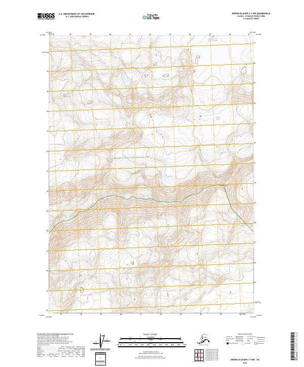
2024 Map of Bering Glacier C-7 NW
USGS Topo · Published 2024About this map
Wrangell-Saint Elias National Park encompasses this high-elevation landscape, where immense ice fields dominate the topography. The northern portion of the map is defined by the Middle Fork Lobe Bremner Glacier and the main body of the Bremner Glacier, illustrating the complex flow of ice through the Chugach Mountains. To the south, the Martin River Glacier extends across the lower sections of the quadrangle, separated from the northern ice by a significant mountain ridge. A primary landmark in this vertical environment is Mt Hawkins, which stands along the boundary of the Wrangell-St. Elias Wilderness. The interplay of these glacial systems and the protected status of the land reflect the remote and preserved character of this Alaskan interior.
Find a feature on this map
10 named features on this map. Tap any name to fly to it.
Don’t see what you’re looking for? This feature index may not catch every label — zoom into the map to look around manually.
Map Details
Editions of this 2024 Bering Glacier C-7 NW Map
This is the sole edition of this map. No revisions or reprints were ever made.
Other maps of this area

1950 · Bering Glacier
USGS Topo · 1:250,000

1951 · Bering Glacier
USGS Topo · 1:250,000

1959 · Bering Glacier
USGS Topo · 1:250,000
1984 · Bering Glacier D-7
USGS Topo · 1:63,360
1984 · Bering Glacier D-8
USGS Topo · 1:63,360
1985 · Bering Glacier C-7
USGS Topo · 1:63,360
1985 · Bering Glacier C-8
USGS Topo · 1:63,360
2014 · Bering Glacier C-8 SE
USGS Topo · 1:25,000
2014 · Bering Glacier C-8 NE
USGS Topo · 1:25,000
2014 · Bering Glacier C-7 NE
USGS Topo · 1:25,000