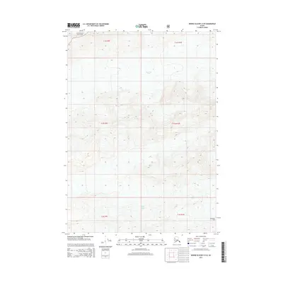
2014 Map of Bering Glacier C-8 SE
USGS Topo · Published 2014About this map
Martin River Glacier dominates the central topography of this northern coastal reach, where massive ice fields shape the drainage patterns of the Chugach National Forest. The map captures the complex interaction between glacial recession and the emerging landforms, most notably in the south where the Steller Glacier meets the rising elevations of the Plenisner Hills. This 2014 survey serves as a vital record of the shifting ice boundaries within the Unorganized Borough, providing precise contour data for the steep, unnamed ridges that separate these two major glacial systems. The absence of permanent settlements or infrastructure underscores the wilderness character of the region, where the landscape is defined entirely by moving ice and ancient rock.
Find a feature on this map
10 named features on this map. Tap any name to fly to it.
Don’t see what you’re looking for? This feature index may not catch every label — zoom into the map to look around manually.
Map Details
Editions of this 2014 Bering Glacier C-8 SE Map
This is the sole edition of this map. No revisions or reprints were ever made.
Other maps of this area

1950 · Bering Glacier
USGS Topo · 1:250,000

1951 · Bering Glacier
USGS Topo · 1:250,000

1959 · Bering Glacier
USGS Topo · 1:250,000
1985 · Bering Glacier C-7
USGS Topo · 1:63,360
1985 · Bering Glacier B-8
USGS Topo · 1:63,360
1985 · Bering Glacier B-7
USGS Topo · 1:63,360
1985 · Bering Glacier C-8
USGS Topo · 1:63,360
2014 · Bering Glacier B-7 NW
USGS Topo · 1:25,000
2014 · Bering Glacier C-8 NW
USGS Topo · 1:25,000
2014 · Bering Glacier C-8 NE
USGS Topo · 1:25,000