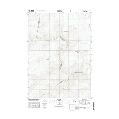
2014 Map of Bering Glacier C-8 NE
USGS Topo · Published 2014About this map
Mount Tom White stands as a prominent landmark within this glaciated expanse of the Chugach Mountains, where the boundaries of the Chugach National Forest and Wrangell-Saint Elias National Park intersect. This 2014 survey documents a complex hydrological landscape defined by massive ice fields, including the Miles Glacier, Martin River Glacier, and the smaller Fan Glacier. The map illustrates the rugged transition between these protected federal lands, showing how the glacial arms of Wernicke Glacier and others carve through high-elevation terrain. This detailed topograhic study captures the mid-2010s state of these remote Alaskan ice systems before continued environmental shifts altered their margins.
Find a feature on this map
14 named features on this map. Tap any name to fly to it.
Don’t see what you’re looking for? This feature index may not catch every label — zoom into the map to look around manually.
Map Details
Editions of this 2014 Bering Glacier C-8 NE Map
This is the sole edition of this map. No revisions or reprints were ever made.
Other maps of this area

1950 · Bering Glacier
USGS Topo · 1:250,000

1951 · Bering Glacier
USGS Topo · 1:250,000

1959 · Bering Glacier
USGS Topo · 1:250,000
1984 · Bering Glacier D-7
USGS Topo · 1:63,360
1984 · Bering Glacier D-8
USGS Topo · 1:63,360
1985 · Bering Glacier C-7
USGS Topo · 1:63,360
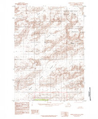
1985 · Bering Glacier C-8
USGS Topo · 1:63,360
2014 · Bering Glacier C-8 SE
USGS Topo · 1:25,000
2014 · Bering Glacier C-8 NW
USGS Topo · 1:25,000
2014 · Bering Glacier C-7 SW
USGS Topo · 1:25,000