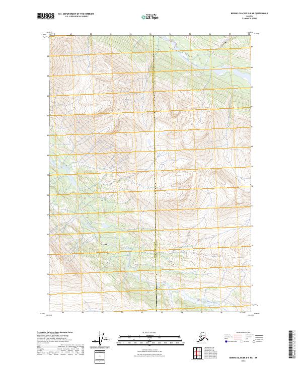
2024 Map of Bering Glacier D-8 NE
USGS Topo · Published 2024About this map
Wrangell-St Elias Wilderness dominates this remote Alaskan landscape, where the high-altitude terrain is defined by the complex convergence of glacial drainage systems. The northern portion of the map is marked by the dramatic descent of Twelvemile Canyon, which channels the North Fork Bremner River as it flows westward. Further south, the Middle Fork Bremner River winds through the wilderness, showing the intricate hydrography of the region's interior. This 2024 survey also illustrates the administrative divide between the Chugach Census Area and the Copper River Census Area, a boundary that cuts through some of the most isolated mountain territory in the state. Small tributaries like Amy Creek feed into the larger river systems, illustrating the raw, unpopulated character of this protected wilderness area in the early 21st century.
Find a feature on this map
10 named features on this map. Tap any name to fly to it.
Don’t see what you’re looking for? This feature index may not catch every label — zoom into the map to look around manually.
Map Details
Editions of this 2024 Bering Glacier D-8 NE Map
This is the sole edition of this map. No revisions or reprints were ever made.
Other maps of this area

1950 · McCarthy A-8
USGS Topo · 1:63,360

1950 · Bering Glacier
USGS Topo · 1:250,000

1951 · McCarthy
USGS Topo · 1:250,000

1951 · Bering Glacier
USGS Topo · 1:250,000

1959 · Bering Glacier
USGS Topo · 1:250,000

1959 · McCarthy A-7
USGS Topo · 1:63,360

1960 · McCarthy
USGS Topo · 1:250,000
1984 · Bering Glacier D-7
USGS Topo · 1:63,360
1984 · Bering Glacier D-8
USGS Topo · 1:63,360
2014 · Bering Glacier D-7 SW
USGS Topo · 1:25,000