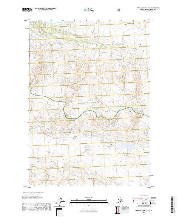
2024 Map of Bering Glacier D-8 SW
USGS Topo · Published 2024About this map
Fan Glacier and Wernicke Glacier dominate this remote landscape of the Chugach Census Area, where glacial systems define the topography within vast protected territories. This region is a juncture of significant federal land designations, where the southern reaches of Wrangell-Saint Elias National Park and the Wrangell-St Elias Wilderness meet the northern boundaries of the Chugach National Forest. The map illustrates the extreme verticality and ice-carved drainage patterns characteristic of the Saint Elias Mountains. These immense glaciers serve as primary indicators of environmental change in the Alaskan interior, their massive footprints shaping the high-altitude terrain across multiple township lines including t11s r8e and t13s r9e. Researchers and historians can observe the precise boundaries where national forest and park lands converge amidst the ice fields.
Find a feature on this map
11 named features on this map. Tap any name to fly to it.
Don’t see what you’re looking for? This feature index may not catch every label — zoom into the map to look around manually.
Map Details
Editions of this 2024 Bering Glacier D-8 SW Map
This is the sole edition of this map. No revisions or reprints were ever made.
Other maps of this area

1948 · Cordova
USGS Topo · 1:250,000

1950 · Bering Glacier
USGS Topo · 1:250,000

1951 · Bering Glacier
USGS Topo · 1:250,000

1951 · Cordova
USGS Topo · 1:250,000

1959 · Cordova D-1
USGS Topo · 1:63,360

1959 · Cordova C-1
USGS Topo · 1:63,360

1959 · Bering Glacier
USGS Topo · 1:250,000

1959 · Cordova
USGS Topo · 1:250,000
1984 · Bering Glacier D-8
USGS Topo · 1:63,360
1985 · Bering Glacier C-8
USGS Topo · 1:63,360