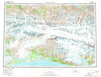
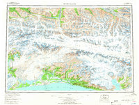
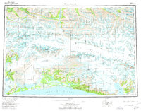
1959 Map of Bering Glacier
USGS Topo · Published 1970About this map
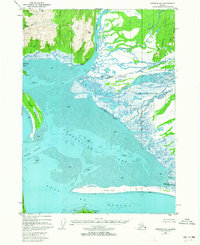
Bering Glacier dominates this massive ice and rock landscape of the Gulf Coast, flowing from the Bagley Ice Field toward the Gulf of Alaska. The coastal fringe near Cape Yakataga represents a rare point of human presence in the late 1950s, supported by the Yakataga Airport. This transition between the Chugach Mountains and the Saint Elias Mountains is defined by a dense network of glacial outlets, including the Miles Glacier, Yahtse Glacier, and the western edge of the Malaspina Glacier. In contrast to the high alpine ridges like Waxell Ridge and Granite Range, the coastline is marked by complex hydrography where the Bering River and Kallakh River meet the sea near Sunshine Point. The map illustrates the immense scale of the Alaskan wilderness before more modern navigational infrastructure was established, showing the international boundary with Canada along the high peaks of the Saint Elias range.
Find a feature on this map
74 named features on this map. Tap any name to fly to it.
Don’t see what you’re looking for? This feature index may not catch every label — zoom into the map to look around manually.
Map Details
Editions of this 1959 Bering Glacier Map
4 editions found

Other maps of this area

1948 · Cordova
USGS Topo · 1:250,000

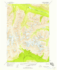
1948 · Icy Bay D-2 and D-3
USGS Topo · 1:63,360

1948 · Middleton Island
USGS Topo · 1:250,000

1948 · Bering Glacier A-4
USGS Topo · 1:63,360

1950 · Middleton Island
USGS Topo · 1:250,000

1950 · Bering Glacier A-3
USGS Topo · 1:63,360
1950 · McCarthy A-8
USGS Topo · 1:63,360

1950 · Bering Glacier
USGS Topo · 1:250,000

1950 · Icy Bay
USGS Topo · 1:250,000
1950 · Cordova A-1
USGS Topo · 1:63,360