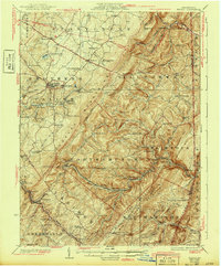
1929 Map of Berlin
USGS Topo · Published 1943About this map
Allegheny Mountain and Savage Mountain dominate this part of the Somerset County landscape, where early 20th-century coal extraction and transportation corridors shaped local development. The presence of the Salco Mines and Shipley Bros Mine underscores the region's industrial reliance on mining, while the Baltimore and Ohio RR traverses the southern terrain through engineering feats like the Falls Cut Tunnel and near the Sand Patch settlement.
Find a feature on this map
97 named features on this map. Tap any name to fly to it.
Don’t see what you’re looking for? This feature index may not catch every label — zoom into the map to look around manually.
Map Details
Editions of this 1929 Berlin Map
3 editions found

Other maps of this area

1898 · Frostburg
USGS Topo · 1:62,500

1899 · Flintstone
USGS Topo · 1:62,500

1899 · Grantsville
USGS Topo · 1:62,500

1900 · Flintstone
USGS Topo · 1:62,500

1901 · Frostburg
USGS Topo · 1:62,500

1904 · Grantsville
USGS Topo · 1:62,500

1908 · Frostburg
USGS Topo · 1:62,500

1908 · Bedford
USGS Topo · 1:62,500

1910 · Bedford
USGS Topo · 1:62,500

1913 · Somerset
USGS Topo · 1:62,500