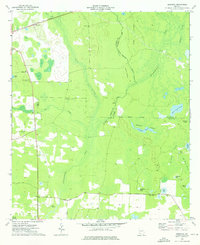
1974 Map of Bermuda
USGS Topo · Published 1976About this map
The Central of Georgia railroad cuts through the northern landscape of this Southwest Georgia territory, passing the small settlement of Bermuda. Much of the quadrangle is defined by the complex hydrology of the Chickasawhatchee Creek system and Spring Creek, where the terrain transitions into a dense network of wetlands with evocative names like Hellgate Swamp, Reynolds Swamp, and the curious 42d Street Swamp.
Find a feature on this map
38 named features on this map. Tap any name to fly to it.
Don’t see what you’re looking for? This feature index may not catch every label — zoom into the map to look around manually.
Map Details
Editions of this 1974 Bermuda Map
This is the sole edition of this map. No revisions or reprints were ever made.
Other maps of this area

1953 · Dothan
USGS Topo · 1:250,000

1954 · Dothan
USGS Topo · 1:250,000

1955 · Dothan
USGS Topo · 1:250,000

1956 · Newton
USGS Topo · 1:62,500

1956 · Sasser
USGS Topo · 1:62,500

1973 · Morgan
USGS Topo · 1:24,000

1973 · Pretoria
USGS Topo · 1:24,000
1973 · Holt
USGS Topo · 1:24,000

1974 · Elmodel
USGS Topo · 1:24,000
1974 · Newton
USGS Topo · 1:24,000