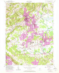
1954 Map of Bernardsville
USGS Topo · Published 1972About this map
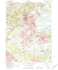
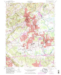
Bernardsville and Basking Ridge serve as the primary hubs in this mid-century portrait of Somerset County, where the sprawling campus of the U S Veterans Hospital sits just south of Lyons. The landscape is defined by the sharp contrast between the rising elevations of Bernards Mountain to the northwest and the low, marshy wetlands surrounding the Dead River and Passaic River to the south and east.
Find a feature on this map
51 named features on this map. Tap any name to fly to it.
Don’t see what you’re looking for? This feature index may not catch every label — zoom into the map to look around manually.
Map Details
Editions of this 1954 Bernardsville Map
6 editions found
Other maps of this area

1888 · Plainfield
USGS Topo · 1:62,500

1888 · Morristown
USGS Topo · 1:62,500

1888 · Lake Hopatcong
USGS Topo · 1:62,500

1891 · Somerville
USGS Topo · 1:62,500

1893 · Plainfield
USGS Topo · 1:62,500

1893 · Somerville
USGS Topo · 1:62,500

1894 · Morristown
USGS Topo · 1:62,500

1894 · Lake Hopatcong
USGS Topo · 1:62,500

1898 · Lake Hopatcong
USGS Topo · 1:62,500

1898 · Morristown
USGS Topo · 1:62,500
Featured Places
- Bridgewater Township, NJ
- Long Hill Township, NJ
- Bedminster Township, NJ
- Bernardsville, NJ
- Basking Ridge, NJ