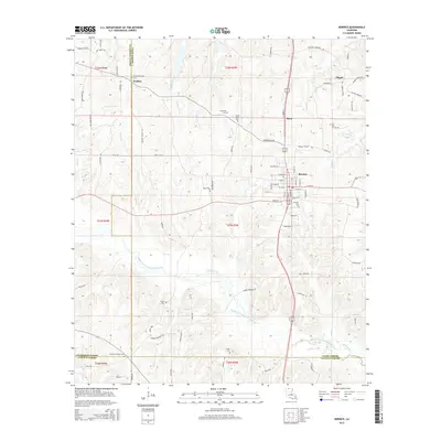
2015 Map of Bernice
USGS Topo · Published 2015About this map
Bernice serves as the primary hub in this portion of north Louisiana, situated at the junction of several key routes and the historic Railroad St corridor. The landscape is defined by the winding course of the Middle Fork Bayou D'Arbonne and its many tributaries, including Cane Cr and Lynn Creek. For those researching local family history, several small settlements and rural landmarks are well-documented, such as Weldon to the northwest and Hunt to the north. Numerous burial grounds are mapped across the countryside, including the Alabama-Weldon Cem, Hopewell Cem, and the Harmony Chapel Cem near the southern border. The map also captures the transition between Union and Claiborne parishes, showing a network of rural roads like Double Bridges Rd that connect isolated farms and churches to the larger community at Pisgah.
Find a feature on this map
95 named features on this map. Tap any name to fly to it.
Don’t see what you’re looking for? This feature index may not catch every label — zoom into the map to look around manually.
Map Details
Editions of this 2015 Bernice Map
This is the sole edition of this map. No revisions or reprints were ever made.
Other maps of this area

1950 · Ruston
USGS Topo · 1:62,500

1950 · Arcadia
USGS Topo · 1:62,500

1951 · Arcadia
USGS Topo · 1:62,500

1951 · Ruston
USGS Topo · 1:62,500

1951 · Summerfield
USGS Topo · 1:62,500

1951 · Bernice
USGS Topo · 1:62,500

1955 · Shreveport
USGS Topo · 1:250,000

1956 · Shreveport
USGS Topo · 1:250,000

1984 · Shreveport
USGS Topo · 1:250,000

1985 · Monroe North
USGS Topo · 1:100,000