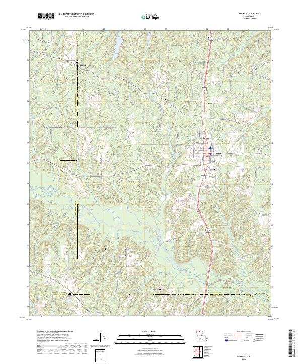
2024 Map of Bernice
USGS Topo · Published 2024About this map
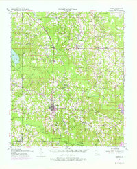
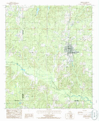
Bernice serves as the central hub of this North Louisiana landscape, where the town's street grid is flanked by the Bernice Cem and established road corridors. The terrain is defined by the winding course of the Middle Fork Bayou D'Arbonne, which cuts through the southern reaches of the quadrangle, joined by tributaries such as Lynn Creek and Jones Creek. This area of Union Parish is characterized by a high density of rural burial grounds, including the Alabama-Weldon Cem near the settlement of Weldon and the Mount Olive Cem further east.
Find a feature on this map
99 named features on this map. Tap any name to fly to it.
Don’t see what you’re looking for? This feature index may not catch every label — zoom into the map to look around manually.
Map Details
Editions of this 2024 Bernice Map
This is the sole edition of this map. No revisions or reprints were ever made.