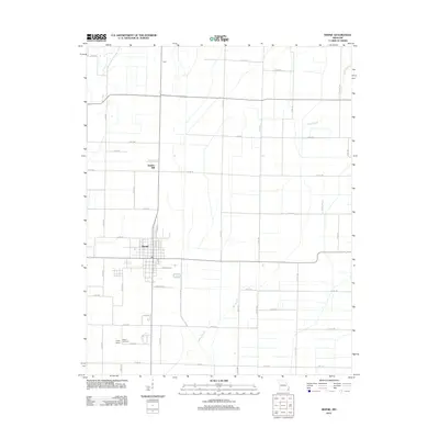
2012 Map of Bernie
USGS Topo · Published 2012About this map
Bernie serves as the central hub for this corner of Stoddard County, Missouri, characterized by a highly organized grid of rural roads and the low-lying drainage of the Mississippi Embayment. The landscape is defined by its agricultural layout, where Bess Slough winds through the eastern and southern reaches, indicating the flat, alluvial nature of the bootheel region. Local heritage is preserved at the Poplin School and adjacent Poplin Cemetery to the south, while small named clusters like Hazel and Bunker Hill mark the northward extension of the community along the highway corridor. The transition from the town's residential streets, such as N Drake St and S Co Circle Dr, into the surrounding farmland is immediate, with the survey capturing the specific footprint of rural life in the early 21st century.
Find a feature on this map
49 named features on this map. Tap any name to fly to it.
Don’t see what you’re looking for? This feature index may not catch every label — zoom into the map to look around manually.
Map Details
Editions of this 2012 Bernie Map
This is the sole edition of this map. No revisions or reprints were ever made.
Other maps of this area

1934 · Bloomfield
USGS Topo · 1:62,500

1934 · Puxico
USGS Topo · 1:62,500

1939 · Bloomfield
USGS Topo · 1:62,500

1939 · Puxico
USGS Topo · 1:62,500

1940 · Malden
USGS Topo · 1:62,500

1940 · Valley Ridge
USGS Topo · 1:62,500

1949 · Bloomfield
USGS Topo · 1:62,500

1956 · Valley Ridge
USGS Topo · 1:62,500

1956 · Malden
USGS Topo · 1:62,500

1956 · Dyersburg
USGS Topo · 1:250,000