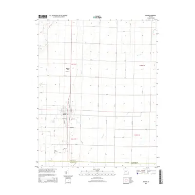
2015 Map of Bernie
USGS Topo · Published 2015About this map
Bernie and its surrounding agricultural grid define this landscape in the southeastern corner of the state, where the drainage patterns of the Bootheel are clearly visible. The town center is detailed with local street names such as Walter Ave, while the broader region is crisscrossed by an extensive network of county roads and drainage systems. The presence of Main Ditch and Bess Slough illustrates the significant water management required for this fertile farming area. Further north, the settlement of Bunker Hill sits along the section lines near Thurston Ln. This 2015 edition provides a precise view of the rural landscape just before it meets the borders of Stoddard Co, Dunklin Co, and New Madrid Co. To the south, Poplin Cemetery serves as a notable landmark for those researching family history in this corner of the county.
Find a feature on this map
80 named features on this map. Tap any name to fly to it.
Don’t see what you’re looking for? This feature index may not catch every label — zoom into the map to look around manually.
Map Details
Editions of this 2015 Bernie Map
This is the sole edition of this map. No revisions or reprints were ever made.
Other maps of this area

1934 · Bloomfield
USGS Topo · 1:62,500

1934 · Puxico
USGS Topo · 1:62,500

1939 · Bloomfield
USGS Topo · 1:62,500

1939 · Puxico
USGS Topo · 1:62,500

1940 · Malden
USGS Topo · 1:62,500

1940 · Valley Ridge
USGS Topo · 1:62,500

1949 · Bloomfield
USGS Topo · 1:62,500

1956 · Valley Ridge
USGS Topo · 1:62,500

1956 · Malden
USGS Topo · 1:62,500

1956 · Dyersburg
USGS Topo · 1:250,000