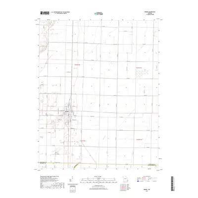
2017 Map of Bernie
USGS Topo · Published 2017About this map
The settlement of Bernie occupies the heart of this Missouri Bootheel landscape, organized by a precise grid of agricultural roads and drainage infrastructure. This late-2010s survey captures the area's transition into the modern era while preserving the footprint of its earlier development, visible in the street names and family-named landmarks. The town center is defined by a dense network of residential and commercial thoroughfares, including W Main Ave, E Main Ave, and W Crumb Ave. Surrounding the town, the land is dominated by significant water management features like Main Ditch and Bess Slough, which are essential to the region's productive agricultural economy. For genealogists, the Poplin Cem south of town provides a specific point of interest for family research. The map also documents the triple-county intersection where Stoddard, Dunklin, and New Madrid counties meet, illustrating the complex jurisdictional boundaries of this low-lying riverine region.
Find a feature on this map
64 named features on this map. Tap any name to fly to it.
Don’t see what you’re looking for? This feature index may not catch every label — zoom into the map to look around manually.
Map Details
Editions of this 2017 Bernie Map
This is the sole edition of this map. No revisions or reprints were ever made.
Other maps of this area

1934 · Bloomfield
USGS Topo · 1:62,500

1934 · Puxico
USGS Topo · 1:62,500

1939 · Bloomfield
USGS Topo · 1:62,500

1939 · Puxico
USGS Topo · 1:62,500

1940 · Malden
USGS Topo · 1:62,500

1940 · Valley Ridge
USGS Topo · 1:62,500

1949 · Bloomfield
USGS Topo · 1:62,500

1956 · Valley Ridge
USGS Topo · 1:62,500

1956 · Malden
USGS Topo · 1:62,500

1956 · Dyersburg
USGS Topo · 1:250,000