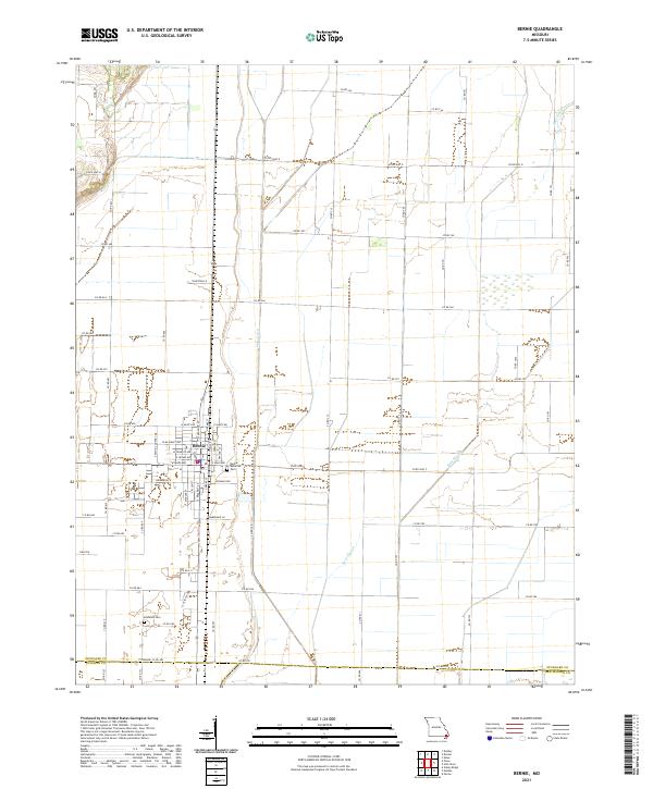
2021 Map of Bernie
USGS Topo · Published 2021About this map
Bernie sits at the intersection of rural agriculture and established street grids in Stoddard County, serving as a focal point for the surrounding flatlands. The town's layout is meticulously detailed, showcasing thoroughfares such as W Main Ave, E Main Ave, and W Crumb Ave that define its residential and commercial core. On the outskirts, the landscape is heavily influenced by water management systems like the Main Ditch and Bess Slough, which are essential to the drainage and productivity of this low-lying region. Local history is anchored by the Bernie Memorial Cem near the town center and the more secluded Edmonds Cem to the southwest. The map also delineates the southern boundary where Stoddard County meets Dunklin and New Madrid counties, illustrating the transition between these Southeast Missouri administrative areas.
Find a feature on this map
57 named features on this map. Tap any name to fly to it.
Don’t see what you’re looking for? This feature index may not catch every label — zoom into the map to look around manually.
Map Details
Editions of this 2021 Bernie Map
This is the sole edition of this map. No revisions or reprints were ever made.
Other maps of this area

1934 · Bloomfield
USGS Topo · 1:62,500

1934 · Puxico
USGS Topo · 1:62,500

1939 · Bloomfield
USGS Topo · 1:62,500

1939 · Puxico
USGS Topo · 1:62,500

1940 · Malden
USGS Topo · 1:62,500

1940 · Valley Ridge
USGS Topo · 1:62,500

1949 · Bloomfield
USGS Topo · 1:62,500

1956 · Valley Ridge
USGS Topo · 1:62,500

1956 · Malden
USGS Topo · 1:62,500

1956 · Dyersburg
USGS Topo · 1:250,000