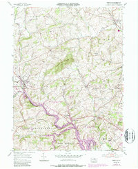
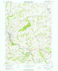
1955 Map of Bernville
USGS Topo · Published 1987About this map
Tulpehocken Creek winds through the heart of Berks County, defining a landscape where rural crossroads and public institutions meet. The 1955 survey, updated in the 1980s, captures the significant geographical shift following the creation of Blue Marsh Lake, which transformed the local valley topography. Surrounding the water, the expansive State Game Lands No 280 provides a wooded buffer for small settlements like Mt Pleasant and Garfield. Local genealogy and social history are well-represented by long-standing landmarks such as Bellemans Ch and the Stump Cem, alongside municipal infrastructure including the County Prison, Sanatorium, and the County Home and Hospital. The map detail reaches from the borough of Bernville in the west to the heights of Scull Hill, illustrating the transition from traditional farming townships to modern conservation and recreational land use.
Find a feature on this map
41 named features on this map. Tap any name to fly to it.
Don’t see what you’re looking for? This feature index may not catch every label — zoom into the map to look around manually.
Map Details
Editions of this 1955 Bernville Map
5 editions found
Other maps of this area

1889 · Pottsville
USGS Topo · 1:62,500

1891 · Pottsville
USGS Topo · 1:62,500

1894 · Reading
USGS Topo · 1:62,500

1902 · Wernersville
USGS Topo · 1:62,500

1909 · Hamburg
USGS Topo · 1:62,500

1911 · Hamburg
USGS Topo · 1:62,500

1913 · Reading
USGS Topo · 1:62,500

1915 · Reading
USGS Topo · 1:62,500

1943 · Wernersville
USGS Topo · 1:62,500

1944 · Reading
USGS Topo · 1:62,500
Featured Places
- North Heidelberg Township, PA
- Bernville, PA
- Centerport, PA
- Penn Township, PA
- Lower Heidelberg Township, PA